
English| USD
Suggested for you
More currencies
Choose a language
Sicily's coastline stretches across three distinct seas, each offering different underwater terrain and marine life. This guide maps the island's accessible snorkeling locations, from the protected coves of the Ionian coast to the volcanic formations along the Tyrrhenian shore, and explains how to choose sites that match your skill level and the season you're visiting.
Quick answer
The most accessible entry point on a snorkeling Sicily map is Isola Bella near Taormina, where a rocky isthmus connects the mainland to a small nature reserve with shallow reefs and clear visibility from late spring through early autumn. The site requires no entrance fee and involves descending approximately 100 steps from the main road to reach the pebble beach. Arriving between 8:00 and 10:30 AM provides the calmest water and fewest swimmers, while afternoon winds and boat traffic can reduce visibility along this stretch of the Ionian coast.
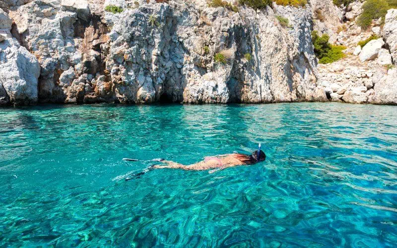
Sicily sits at the center of three Mediterranean basins, and the underwater topography shifts dramatically as you move from east to west. The Ionian coast near Taormina features steep drop-offs and volcanic rock formations, while the southern shore offers sandy shallows with seagrass meadows, and the Tyrrhenian side is characterized by deeper channels and offshore islands. The most detailed snorkeling Sicily map will mark protected marine areas where fishing restrictions have allowed sea life to recover. Isola Bella, just below Taormina, became a nature reserve in 1998, and the shallow waters around the isthmus now host damselfish, octopus, and seasonal schools of barracuda. The reserve's rocky substrate creates dozens of small caves and overhangs within three meters of the surface, making it suitable for beginners. Further north, the Aeolian Islands offer black volcanic sand and fumarole vents, though these sites require boat access and favor intermediate swimmers due to currents. On the western coast, the Egadi archipelago near Trapani contains Sicily's largest marine protected area. Cala Rossa on Favignana and the Blue Marino cave on Marettimo provide sheltered entry points with visibility often exceeding 30 meters during summer months. The seabed here transitions quickly from shallow boulder fields to vertical walls, and Neptune grass meadows support a different ecosystem than the eastern rockscapes. Ustica, a small island 60 kilometers north of Palermo, is encircled by a marine reserve established in 1986 and remains one of the Mediterranean's most biodiverse snorkeling destinations, though it requires a ferry crossing. Water temperature varies by location and season. The Ionian coast warms earliest in spring, typically reaching 20°C by May, while the Tyrrhenian side remains cooler until June. Wind patterns also differ: the sirocco brings warm air and reduced visibility to the south coast, while the mistral can create chop along the northwest shore even in summer. Consulting a regional snorkeling Sicily map with seasonal overlays helps avoid sites that are calm in July but exposed in September. Most coastal access points are public, though some beaches charge for sunbed and umbrella rentals. A few marine reserves require snorkelers to register at small kiosks near the entry, though there is no fee to enter the water. Local dive shops near major sites rent masks, fins, and wetsuits, and many offer guided excursions to offshore reefs not accessible from shore.
“The underwater topography shifts dramatically as you move from east to west, with volcanic rock formations giving way to seagrass meadows and deeper channels.”
The best arrival window for snorkeling in Sicily is between 08:00–10:30 to ensure clearer water conditions and fewer crowds. Planning your visit during these morning hours provides the most favorable environment for exploring coastal sites.
Water 24°C–26°C; clear skies
The peak season offers the warmest water, though beaches are busiest during midday.
Water 22°C–24°C; mild air
Sea temperatures remain comfortable for extended snorkeling sessions as air temperatures decrease.
—
Arriving during the 08:00–10:30 window avoids weekend surges and provides the calmest water surface.
Verdict: For the best experience, target the 08:00–10:30 window during the months of September or October.
Coastal access to snorkeling sites remains open daily throughout the week.
The primary snorkeling site at Isola Bella is located in Taormina, accessible via the coastal road leading toward the beach area. Visitors can reach the vicinity by public transport or private vehicle before completing the final descent on foot.
Interbus line from Taormina terminal to Isola Bella stop
SS114 road toward Taormina Mare
Access path from the main road to the shoreline
Plan to arrive between 08:00 and 10:30 to secure parking and manage the 100-step descent to the water while conditions remain favorable. Be prepared for the physical access requirement as the path to the snorkeling zone involves descending 100 steps.
Rocky coastal entries and open-water conditions require specific equipment and preparation.
Everything you need to know about snorkeling sicily map
You can use an interactive snorkeling sicily map to locate popular marine reserves and coastal hotspots. These digital tools often highlight visibility conditions and local currents across the island. Using a well-maintained snorkeling sicily map helps you navigate popular areas like Taormina and the Aegadian Islands efficiently. Access to public coastal areas is free, so there is an entrance fee of 0 EUR. You do not need to pay to access the shoreline for snorkeling, though some private boat tours may charge for transport. Planning your visit with a snorkeling sicily map allows you to prioritize these accessible public sites. The best arrival window is 08:00–10:30 to avoid crowds and enjoy clearer water conditions. This timeframe is ideal for underwater visibility before the heat of the day. Reaching the water at Isola Bella requires navigating a path of 100 steps. Be prepared for this descent when planning your trip to the coast. Using a map of Sicily snorkeling spots is great for families, as it helps identify sheltered bays with calmer waters. Always verify that a chosen location is supervised or suitable for younger swimmers before entering. The site is open monday through sunday from 00:00–23:59. You may arrive at any time, though early morning remains the best period for marine life observation.
Best Snorkeling Spots in Sicily
Read more GuideSnorkeling Safety and FAQs
Read more GuideTop Snorkeling Beaches in Sicily
Read more GuideClearest Water in Sicily
Read more Tickets & toursSnorkeling in Taormina
Read more Tickets & toursSnorkeling in Cefalù
Read more Tickets & toursSnorkeling in Catania
Read more